Wednesday, 16 June 2010

Monday 31st May 2010 – Llanychaer


A lazy start was followed by a walk along the valley, this time beyond Llanychaer. This section had been recommended to us by the allotment gardener. She was quite correct, it was even prettier than the lower section. The wide path follows the river, sometimes close through woodland and other times on the edge of woodland with meadowland between the path and the river. The sound of the river is ever present and mini waterfalls and natural weirs add to its attractiveness. Meeting the river at Cilrhedyn Bridge we turned around and walked back on the same route. The weather was perfect for walking – sunny and warm with hardly any breeze.
Just at the end of the walk we met a family who were doing a similar walk and thoroughly enjoying it. Their young daughters had just been for a swim in the river, much to the surprise of their parents and us – it must have been freezing! These were the only people that we met on the 6 km walk.
As we approached the road close to campsite we met, for the third time, the barking but friendly dog at Ty-Hen. The owner had told us that the dog shouldn't run, a bit of a problem when a footpath runs through the property and the dog can wander freely. Apparently the dog had bone cancer in its leg and instead of the normal treatment of amputation, it had a titanium implant to replace the bone in its leg. It is only the 17th time this procedure had been done in the UK and she is still receiving chemotherapy. A much loved and very expensive bionic dog! The operation seemed to be an amazing success and we would never have known that she had a titanium leg.
Photos: Horses in the Gwaun Valley; Mini waterfall on the Gwaun river.

Sunday 30th May 2010 – Llanychaer


The weather was overcast but it wasn't raining and the forecast was good so we decided to go for a long walk to make up for yesterday's inactivity.
The walk started on the same path as the one on Friday but this time we turned left after cross the river. We were soon walking up the steep valley side through a profusion of white flowers and the smell of wild garlic. Shortly after reaching the top we came to to Llanllawer's dilapidated church and next to it, a holy well. In pre-Christian times this was a 'cursing well' where visitors could leave a bent pin to cement a curse or an ill omen. However, most pilgrims came seeking miraculous cures, especially for problems, a much more pleasant story.
Walking along the road we climbed and were rewarded with lovely views down to Fishguard and Goodwick and up the hill of Mynydd Dinas with its distinctive rocky outcrop. We passed three large standing stones built into a field wall whilst we were on our way to the 'Field of the Dead'. This is an alignment of seven standing stones, the longest in Wales, and it is very well hidden because there are no signs to it and we couldn't find it! However we saw other standing stones and large numbers of huge stones incorporated into field walls, laying around in fields or used as gate posts. It seems highly likely that there were many other standing stones, possibly in alignments, that were removed by farmers. They would have chosen the smaller ones, the easier ones to move and more useful as gateposts! They left the larger ones and ones that didn't get in the way. Of course, the stones may have all been just lying around but I can't help thinking that there would have been more and longer alignments and I would have dug them up if they were in my way when I was trying to plough the fields.
We continued to walk along the hillside until we met the road that took us down into Pontfaen. Here we found the Dyffryn Arms, known locally as 'Bessie's' after its landlady. It is a lovely old traditional pub. The only bar is the front room of the house with a hatch through which the drinks are dispensed. The beer comes direct from the barrel and is a very good pint of Bass. They don't serve food but were very happy for us to eat our sandwiches in their garden. The beer was so good that I had to have a second pint.
We crossed over the stream to walk back down the other side of the valley. This involved climbing on the road to the top of the valley where we came across Pontfaen church dedicated to St. Brynach. The very small church has an ancient origin, with two churchyard crosses dating to some time between the 6th and 9th centuries. It is thought that the site was used in pre-Christian times as the circular churchyard suggests that a prehistoric settlement may have occupied the area.
The walk then took us along the hill with lovely views up and down the valley and across to the area where we had walked in the morning. We descended into a tributary valley hoping to cross the stream, climb up the hill and then descend to the campsite. However the first footpath was totally overgrown and the second option didn't seem to exist, so we continued into Llanychaer and walked back along the road to the campsite.
Photos: The wonderful parlour of Bessie's; St. Brynach's church at Pontfaen.

Saturday 29th May 2010 – Llanychaer


It rained for much of the night and continued to rain for most of the morning. After lunch it brightened up slightly but not enough to venture out. Fortunately we discovered that there was a wonderful day of sport on the television – French Open Tennis on the BBC Red Button, Rugby League play-offs and Rugby Union Magners League final on S4C. And then there is the Guinness Premiership final covered on radio. A very unusual day of being couch potatoes.
Photos: Our pitch at Gwaun Vale when the hills weren't covered by low clouds.

Friday 28th May 2010 – Llanychaer


There was no rain over night and we decide to go for a short walk before lunch. A few metres up the valley on the other side of the road is a footpath that descends to river Gwaun. Although poorly signposted from the main road, there is a very substantial footbridge across the very pretty river. The footpath up the valley is very well maintained with many areas of boards keeping walkers above those often muddy sections. Very large clumps of wild iris were scattered in the marshy area between the footpath and the river. They were just coming into bloom and will be glorious over the next few weeks.
As we approached Llanychaer we met a lady tending her immaculate allotment. She lives in Fishguard but used to live in the village and is using land still owned by the family. We had a long chat that ranged from good walks and good pubs in the area and the location of a local brewery owned by a friend, to controlling slugs that eat potatoes by using natural predators discovered by Bristol University! She was praying for rain as she had to bring water from home in large containers in order to water the many plants. The soil was parched as they had not had any substantial rain for nearly two months. We came to an agreement that there should be heavy rain but only at night!
Llanychaer is a very small village but has an unusual feature at its centre. In the front garden and incorporated into the walls are all sorts of old implements, mainly from farms. This has spread across the road to their garage and a small area of land owned by them. The garage is covered with clematis, something that upset our friendly gardener as this used to be her house and she had tried to grow clematis for many years without success and, even more annoying, this was apparently the same clematis that she left when she sold the house! All around the garage are more antiquities – ploughs, scales, bicycle, beehive and a complete milking set up. Great fun!
The pub has a dilapidated water wheel on one side. This was not the original mill, which was elsewhere in the village, but the blacksmith worked here using water power from the wheel. Purely for historical research, we decided to visit the pub. Unfortunately there was no local real ale but the Bass was good. We walked back via the same path having another, but much shorter, chat with the gardener.
The afternoon was spent relaxing, reading and watching the French Open Tennis on the television.
Photos: The Bridge End Inn, Llanychaer with its dilapidated waterwheel on the left; The clematis-covered garage.

Thursday 27th May 2010 – Llanychaer


Last night the wind was stronger than ever and we were rocked to sleep. However the wind had died down by the morning and the sea looked almost as calm as yesterday but, as we know, this doesn't mean that the boats will run. We phoned at 08:30 and were told that the ferries would be running – Skomer here we come!
We got to the ticket office at 09:20 to find that there was a unpublished sailing at 09:15 and the 10:00 and 10:30 ferries were already fully booked but we got tickets for the 11:00 sailing. We also purchased a guide book and bird recognition leaflet for £3, which was very informative and well worth the cost. Back to Henrietta for a read before getting down to the haven at 10:30. It had been overcast but as we motored across to the island, the sun came out – a good omen.
Fifteen minutes later, a walk up from the landing stage took us to the tiny shop and the briefing from one of the wardens. He gave an excellent introduction to the island, gave us details of possible walks and what to see where. He also gave us one very strict rule - “Do not stray from the marked paths”. He explained that we would damage the burrows but we didn't understand the full significance of this until we continued up to the hill to the relatively flat top of the island. Almost every available square metre of surface is absolutely covered in burrows. There are many thousands of rabbits on the island and they breed, well, like rabbits. However many of the burrows belong to birds such as Manx Shearwaters and Puffins. Despite the fact that the island population of Manx Shearwaters is over 240,000, the largest colony of the bird in the world, we wouldn't see any as they only appear after dark. The birds are very vulnerable to attack from birds of prey and need the cover of darkness to avoid being eaten.
Most visitors headed on the clockwise path as this is the quickest route to the best place to see the Puffins. We chose to take the quieter anti-clockwise path. Our first stop was the Harold Stone, a standing stone, possibly of Prehistoric date, used either as a burial marker or a navigation aid. We moved on to the visitors centre and then north to the Garland Stone. Even from the mainland we could see the flowers on Skomer with large areas of blue and purple. The blue was huge areas of Bluebells and the purple a combination of Bluebells and Red Campion. These appeared all over over the island but the densest area is in the stretch between the visitors centre and the Garland Stone. I have never seen so many bluebells in one place, even more surprising because they are in the open rather than the wooded environment where I would normally expect to see them. A diversion off the main path took us past some prehistoric hut circles almost invisible in amongst the wild flowers.
For a couple of hours either side of low tide, seals lay on the exposed rocks and there were a few conveniently in position when we arrived. Having said that, they were at some distance and they weren't doing a lot. We moved on to the west of the island and Pigstone Bay where a natural rocky outcrop shaped perfectly as a seat gave us an excellent position for a picnic. Down below us eight or nine seals were hunting for fish, diving for long periods and then surfacing, hanging vertically in the water with just their whiskered heads above the surface. It was great entertainment.
It wasn't much further on to The Wick, the main Puffin colony on the trail. On this section we passed much evidence of prehistoric field boundary walls and across the Wick Stream there was a series of seven prehistoric dams, possibly used to water their stock.
As soon as we approached The Wick, there were Puffins everywhere – taking off, flying past, landing, disappearing into burrows or just standing around. Standing around looking pretty, in fact positively posing for all of the photographers with their enormous lenses. We spent a long time watching these fascinating birds. It was easy to pick out the pairs and they would often stand together outside their burrow or change shifts on the eggs. Some were still nest making, bringing in nesting material, a very few had young and were returning with fish for them but most had eggs. And they simply didn't worry about humans, often standing just a few feet from us or even crossing the path between people.
The Puffins are obviously the biggest draw on Skomer but it is a hugely fascinating place with so much to see. There are many species of birds, 40 listed as seen on the island that day, seals, porpoises, wonderful wild flowers and fantastic views. I will always remember one other aspect of our visit to Skomer and that is dead birds. We saw literally hundreds of bird kills – intact wings with just a skeleton between. There were also quite a few rabbit skeletons but these were vastly outnumbered by the birds. Talking to a warden we understood that many of them were Manx Shearwaters that were either young and inexperienced or adults that had misjudged their return, landing when there was still light. We didn't see any birds of prey but they are certainly there and the food source seems to be endless.
After a 45 minute wait we caught a ferry back to the mainland after an unforgettable day.
We drove to Haverfordwest stopping at Morrison's for supplies and then drove on to the Gwaun Valley and the Gwaun Vale Caravan Park at Llanychaer. It proceeded to rain soon after we arrived and we considered ourselves very lucky to have had sunshine for the whole of our visit to Skomer.
Photos: An artist paints the bluebell and campion coloured scene; Posing puffin; A puffin triumvirate; Stretching the wings after emerging from the burrow.

Wednesday 26th May 2010 – West Hook Farm, Marloes


We awoke to calm – no wind buffeting Henrietta, not even wind noise. Pulling up the blinds we inspected the sea – not even a ripple! With great confidence we phone the National Trust ticket office, Lockley Lodge (01646 636 800) at 08:30 to ensure that the ferries were running. “I am sorry, there will be no ferry trips due to the strength of the wind”. There wasn't any wind! However, our protests wouldn't do any good, we weren't going to get to Skomer today.
Unlike yesterday, it was overcast and none too warm. We sat outside with jumpers on and in the late morning it became almost warm as weak sunshine appeared. Rob Thomas, the tenant farmer for the National Trust farm, came over and had a chat, expressing surprise that we hadn't gone to Skomer and we explained that it was due to the (non-existent) wind. He surmised, as I had, that there must be a forecast of stronger winds later in the day. The first ferry off Skomer back to the mainland is at 15:00, so any change in the weather before then would be a problem. As we chatted, a breeze started, the weak sunshine disappeared and the temperature dropped. We abandoned the outside chairs and retreated inside the van. By early afternoon Henrietta was swaying in the wind and the sea was decidedly rough – they had been correct to cancel the ferries.
We wrapped up well and went for a short walk in the afternoon, calling in to the National Trust Lockley Lodge to ask about the prospects for tomorrow. 50/50 we were told. There was still a northerly wind in the morning (bad news) but it was moving around to the west in the afternoon. If the wind wasn't too strong in the morning, the ferries would probably run.
Whilst we were in Lockley Lodge we were also able to confirm that the bird that we had seen yesterday was a Marsh Harrier.
Photos: The closest we have got to seeing a puffin. Two concrete puffins guard the gateway to West Hook Farm. One of the campers has even written an ode to them!

Tuesday 25th May 2010 – West Hook Farm, Marloes


A strong breeze was blowing when we woke this morning and it still seemed to be coming from the north – not a good sign. We prepared for the trip to Skomer but also took with us details of a walk around the peninsular (obtained from the excellent Pembrokeshire Coast National Park site).
Within a few minutes we arrived at St. Martin's Haven to see that the northerly wind was blowing straight into it and the waves were pounding the beach. The National Trust shop confirmed that there would be no ferries that day and tomorrow's prospects were not good.
We set off around the promontory just beyond St. Martin's Haven. This was a very large Iron Age fort with a huge bank and ditch separating it from the mainland. Around 1800 a large stone wall was built on the land side of the bank and ditch. This was meant to convert the promontory into a deer park but no deer were ever introduced. We joined many disappointed birdwatchers walking around the headland, admiring the views over to the inaccessible Skomer and looking for the elusive Puffins. I felt very inadequate – they all had vastly more knowledge of birds than me, their binoculars were many times more powerful and as for their camera lenses, well size obviously does matter in the world of twitchers! Still we did see and identify a Chuff - a first for us – we were really chuffed!
Low tide was rapidly approaching and the sea was rushing through the Jack Sound between Skomer and the Deer Park promontory. This was a very impressive sight but unfortunately we didn't see any of the porpoises that allegedly often hunt there. The walk then took us along the coast until we came to Albion Sands well below us. Here is Gateholm Island, accessible for a couple of hours either side of low tide, an Iron Age fort with many hut circles where there have been finds of pottery and flints. With high cliffs, surrounded on three sides by the sea, all four at high tide and with three banks and ditches on the accessible side, it was wonderfully defended. On the other side of the island is the huge Marloes Sands, a glorious stretch of golden beach. We continued above the beach until the path descended and allowed us to access it. The top of the beach is covered with fascinating rock formations and, together with the gently sloping beach, it provides lots of rock pools that are only covered at high tide. The tall rocks provided plenty of locations sheltered from the cold wind and we found a suitable place for lunch. As the overgrown child that I am, I went off to investigate the rocks and the rock pools, taking my camera with me to provide an excuse.
The visit to the beach was a small diversion from the official walk but following a wide path up from the beach, we soon arrived at the National Trust Marloes Sands car park and rejoined the walk route.
The walk took us back to the bottom of the field in which we camped and sat out in the lea of the van, protecting us from that chilly northerly wind. As we sat there, we watched a bird of prey using the wind to hover over the long grass in our field looking for prey. It was a beautiful bird, a harrier of some sort, possibly a Hen Harrier? Why is it that birds never look the same in the bird books as they do in the flesh?
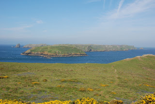
Photos: Skomer Island from the high point of the Iron Age hill fort in the Deer Park; They have intelligent sheep in Wales (the sign reads “Sheep have worked out how to use a kissing gate!!!! Please place loop over gate.”); The rock formations on Marloes Sands with Gateholm Island and Skokholm Island in the background.

Monday 24th May 2010 – West Hook Farm, Marloes


It was time to move on but we thoroughly recommend Trefin, both the great value and very friendly Prendergast Caravan Park and the location for investigating the coast.
We really wanted to go to the island of Skomer and decided to return south and hope that the weather would be kind to us. We stopped first at the Square and Compass fuel station to buy a replacement Campingaz gas cylinder and then drove on to Haverfordwest to stock up at Morrison's.
There are a number of campsites suitable for visiting Skomer but we chose West Hook Farm, which is in walking distance of St. Martin's Haven from where the Skomer ferry leaves. We drove through Marloes and arriving at West Hook Farm we chose one of the enormous pitches. The site is exposed and the facilities are basic, there is no electric hook-up and the showers open straight into the elements – somewhat draughty and cool. However, the views are fantastic, the coastal path runs at the bottom of the field and it is only 5 minutes walk down the road to the ferry.
We took a walk along the coast path to St. Martin's Haven (less than 10 minutes) and called in at the National Trust shop. There are no boats to Skomer on Mondays but they told us that the northerly wind meant that there were unlikely to be any boats on Tuesday. Both St. Martin's Haven and the landing point on Skomer are protected from the prevailing westerly winds but are exposed to any northerly wind. We were also told that there were northerly winds forecast for all of the week and it was possible that there would be no ferries on any day.
Photos: Our pitch at West Hook Farm with its wonderful view; St. Martin's Haven from where the Skomer ferries run.

Sunday 23rd May 2010 - Trefin


We had thought about taking the bus to Trefasser Cross, walking to the coast and then along the coast path back to Trefin. However this was about 10 miles and given that it was going to be another hot day, we decided to take the Strumble Shuttle to the Tregwynt and walk back from there, a distance of about 7 miles. From the stop at the woollen mill we walked back to the T-junction and turned up the hill for a few metres until we came to the footpath to the coast. This runs parallel to the road but we had been told that it was a much more pleasant route. And it was. The track is on the hill and at the edge of the wood with glimpses into the valley below. Very clever wooden and modern sculptures line the first part of the route and there are some lovely typically Welsh cottages on the way to the sea.
The coast path here at Aber Bach crosses the Bach stream and runs along a massive bank of large pebbles. Aber Bach is swiftly followed by Aber Mawr, a popular and very pretty beach. It was very clear and the views along the whole walk were spectacular. The sea has been calm for a number of days but today it was like a mill pond, a beautiful blue and so clear that it was possible to see the sea floor even in the deep parts. Fishing boats glided across the surface, kayaks investigated the rocky shores and sailing boats were practically becalmed. There was not a ripple on the surface.
The coastline along this stretch is particularly interesting with many headlands, rock pillars, arches and stacks. This has been caused by a combination of hard volcanic rock and soft mudstones and schist. The westerly gales attack the softer sections, undermining the cliffs and causing many landfalls. Meanwhile, the harder rocks are left as headlands, often used as forts in the Iron Age. Many birds nest on the cliffs and we saw many different gulls, fulmars, oystercatchers, peregrine falcons, kestrels and others that we couldn't identify. In addition there were many other smaller birds such as skylarks, linnets, wheatears and stonechats.
The birds, wild flowers and beautiful views made this a wonderful walk.
Photos: One of many sculptures on the woodland walk down to Aber Bach; The river meets the sea at Aber Bach; Very handsome Welsh sheep – they taste very good too!; Some of the fascinating geological formations on the coast between Aber Bach and Abercastle.

Saturday 22nd May 2010 - Trefin


Today we went to the North Pole! We took the Pembrokeshire Coast National Park North Pole walk and extended it slightly. We took the Strumble Shuttle bus to Pontiago, a rather long but interesting ride as the bus goes all the way out to Strumble Head and back again before getting to Pontiago. We fell at the first hurdle by trying to follow the marked footpath from the centre of the village to meet the official walk route. This lead into someone's garden and a very nice garden is was too. It was really a field that has been converted into a garden with sculptures and wild parts with paths cut through the grass. There was no way out! We gave up and retraced our steps, taking the road out of the village until we got to the point where the walk crossed it.
We soon diverted from the route to go up the Garn Gilfach hill where wanted to see a burial chamber and standing stone. I had the intention of walking over this Access Land (free access land) to find the burial chamber but discovered that the land was covered in low gorse and brambles and we had to follow two foot paths to get there. We found the chamber just below a rocky outcrop with wonderful views over the countryside and the sea. From here it was only a couple of hundred metres to the standing stone and to get us back onto the walk route. We tried to get through but were defeated by the gorse and brambles that would have torn our legs to pieces by the time that we reached the footpath. This meant a long route round but it did take us through a field full of huge rocks, glacial erratics but looking as if they were part of a ritual prehistoric site.
We then started on our extension to the walk by going through Trehowel Farm to Carregwastad Point. It was at Carregwastad Point that the last invasion of British soil took place. In 1797 French troops landed hoping to be greeted as liberators by Britons keen on revolution. They intended to land at Bristol but were blown off course – an inauspicious start to their campaign. And it got worse! Although there were 1400 soldiers they were not an impressive army, some were recently released prisoners still shackled when they set off. A few hundred metres inland they found Trehowel Farm and made this their base. Unfortunately for them, a wedding was planned at the farm and it was stocked with large amounts of food and drink, much of which had been 'liberated' from a Portuguese shipwreck. This proved too much of a temptation for the French and they soon got drunk. After two days they surrendered at Fishguard claiming that they had seen thousands of British troops. There was no army but they would have seen the Welsh women in their traditional red shawls and stovepipe hats and they mistook these for British Redcoats. One local 47 year woman who became known as the 'Welsh Heroine' captured fourteen French soldiers using a pitchfork!
We picnicked at Carregwastad point eating French Brie but, unfortunately, we didn't have any Portuguese wine to wash it down otherwise we would have drunk to the heath of the Welsh women. Still, it was very hot and we were better off drinking water – just as the French would have been!
We intended to walk a little further west along the coast but we had wasted a lot of time on Garn Gilfach and we had to ensure that we didn't miss the bus back. We walked up to Llanwnda and stopped to take a look at its fascinating church named after the Breton St. Gwyndaf. The church dates back to before the 8th century, has a Norman font, a lepers' squint and has many 7th to 9th century inscribed stones incorporated in the external walls. One of the 15th century roof beams has the figure of a monk carved into it and there is a copy of a 1620 bible in the Welsh language. Well worth the visit.
A short walk on brought us back to Pontiago for the bus back.
We had bought some Gwaun Valley pork chops at Square and Compass and I got the gas barbecue out for the first time on the trip. They were sizzling nicely when the sound of the sizzle started to diminish – the gas had run out! The van grill came into operation and, sometime later, we sat down to some very tasty chops.
Photos: Carregwastad where the French invasion landed; Trehowel Farm where the French enjoyed Portuguese wine; The fascinating church of St. Gwyndaf at Llanwnda.

Friday 21st May 2010 - Trefin


We decided to combine a short walk with some shopping. All of the shops in the village have closed with only a Post Office run in the hallway of a small bungalow but there is a shop in the fuel station in the quaintly named village of Square and Compass. This sounds more like the name of a pub and indeed there is a pub of that name in the village. In Welsh it is simply known as 'Y Sqwar' (Square) but I don't know what came first, the pub or the village.
We started the walk in the same way as yesterday and were better prepared this time for that very wet long grass. When we got to those two fields, we found that they had both been cut for silage. The farmer had seen the forecast for dry sunny weather over the next few days.
Unsurprisingly, given that this is the only shop for miles around, the supermarket prices were very high but it was useful to top up with the essentials that we could fit in my rucksack. It was a pleasant walk with lovely views to the sea.
The afternoon was spent reading and making cheese straws without a recipe. Not enough cheese, must increase it next time.
Photos: Celtic Cross in churchyard near Square and Compass.

Thursday 20th May 2010 - Trefin


In the very good and free Pembrokeshire Coast National Park 'Coast to Coast' publication, we had spotted a guided walk from Trefin for today. The walk started from Trefin but immediately took a bus to Abercastle. Given that the walk didn't start until the afternoon, we decided to start mid-morning and walk to Abercastle by an inland root.
The day was overcast and it had rained overnight. This didn't cause a problem at the start of the walk but when we came to a field of very long grass we started to get very wet. Fortunately, it was quite warm and we knew that we would dry off quickly. After two fields of long grass we came to one that had been recently ploughed and planted. The path took us right across the centre of the field and this allowed us to do a little archaeological field walking. Shards of pottery littered the surface – unfortunately not pre-historic or Roman but plenty of 19th and early 20th century examples. It reminded me of my garden where I find lots of such pottery every time that I dig the vegetable plot.
On the way down to Abercastle we passed Careg Sampson, a burial chamber and discovered a popular Caravan Club Certified Location (CL) site with a view over the ancient monument. All five of the places allowed on CL sites were taken and this is not surprising given its proximity to Abercastle, the coast path and its wonderful sea views.
After wandering around the small village of Abercastle we had our picnic sat on a bench with views over the picturesque bay.
At 14:30 Philip, the Park Ranger, arrived with the group from Trefin and joined us and two others who had made their own way to Abercastle. After an introduction to the area and the mandatory safety warnings, we set off up the hill and headed to Careg Sampson where we learnt a little more about the monument. The stones used are 'glacial erratics', rock broken off and transported by the ice sheets in the last Ice Age and then dropped on the land surface when the ice sheet melted. There is a theory that the cap stone was selected because it reflected the profile of the hills of Strumble Head that can be seen behind it. Other cromlechs are said to have similar cap stones echoing the profile of their local geography. I will let you make your own mind up.
The walk is a short one but it was taken at a very gentle pace and we had many stops when Philip imparted his impressive knowledge and great enthusiasm. Wild flowers and birds were pointed out but the main thrust was about the geology of coastline. The effect of second homes (almost entirely negative) and holiday lets (mixed) were discussed and it was interesting to hear about Trefin when it was a thriving village with two shops and many craftsmen. Trefin is fortunately still a village with many full-time Welsh residents and Porthgain just along the coast is a thriving fishing village but many others, such as Abercastle have very few local inhabitants and many of the houses are empty for most of the year.
Philip is English and only arrived in Pembrokeshire a few years ago but he has taken Welsh lessons and, although not totally fluent, he is able to give his guided walks in Welsh – very impressive. He asked me where I lived and he said that he had moved from Somerset for this job. It turned out that he used to live within 3 miles of our house. He used to work for South Somerset District Council and was responsible for Ham Hill where he had overseen the purchase of much of the land on and around Ham Hill to create the park. He also created the path to the tower and reopened it to the public. I was able to tell him that we had climbed the tower to see the fantastic view and say how much we enjoyed visiting the park. A small world!
Photos: The pretty village of Abercastle; Philip, the Park Ranger, gives us a briefing at Careg Sampson; Careg Sampson.

Wednesday 19th May 2010 - Trefin


It rained for much of the night and although it had stopped in the morning, it was grey, overcast and misty in the distance. This did not inspire us to walk so we decided to spend the day around the van. We were running short of bread so I made some using an Asda bread mix. It only produces a small loaf but is ideal for making in a motorhome. Apart from that, the day was spent reading and writing this blog, catching up from all that time at Angle without an electric hook-up.
Photos: Our pitch at Prendergast Caravan Park.

Tuesday 18th May 2010 - Trefin


After a lazy day yesterday, today we wanted to do a long coastal walk from the campsite.
We left the campsite in bright sunlight and were both wearing sunglasses but within a few minutes the sun disappeared, the glasses were dispensed with and it remained overcast for the rest of the walk. It was however quite warm and the conditions were very pleasant for walking. Walking into the village and down to the sea we followed the coastal path west towards Porthgain. This is a very popular walk and we met many other walkers on the route all of whom had a cheery greeting or stopped to have a chat.
Immediately after leaving Trefin we walked through a stone circle but this was obviously a modern creation as was the standing stone in the next field. The walk to Porthgain, our first target, is easy and most enjoyable. I had particularly wanted to see Porthgain after I had investigated walks for our visit to St. Davids last December. We didn't have time to visit it then but had plenty of time to investigate it on this visit.
The large, white, stone built, inverted ice cream cone of a navigation marker indicated the eastern side of Porthgain harbour. The industrial heritage of the village was immediately apparent – aggregate bins lined the western hill where the sized granite aggregate would be stored and then loaded into ships tied up at the dock below. The granite quarry was a short distance along the coast linked to the harbour by a tramway. Another quarry close inland produced slate and this was the first product exported from the port and was the reason for the creation of the port. The slate was not of great quality but the very hard granite was very hard and produced excellent roadstone. This was sent to ports in South Wales and also South West England, especially the Bristol area. The quarry closed in 1931 but many of the buildings remain and the welsh-speaking village is very alive without the second homes and holiday cottages that leave many Pembrokeshire villages devoid of life outside of the holiday season. A row of slate workers cottages are extant and occupied and the tramway bed can still be followed to the granite quarry.
We walked on to Abereiddi passed the isolated but lovely Traeth Llyfn beach with its curious rock formations. As we walked down towards Abereiddi harbour I heard music playing. I thought that it was celestial music but then realised that it was unlikely that angels played morris dancing music. A couple were sat high above the harbour playing fiddle and concertina and it was very good music. Waiting until they finished the tune, I engaged them in conversation. They were from Leominster Morris and the fiddler was learning some new tunes in preparation for an appearance in June at the Garway Folk Festival on the English side of the Welsh border.
Following the tramway round the corner we came across the so called 'Blue Lagoon' a deep disused slate quarry. After quarrying was discontinued, the local fishermen blasted through the quarry wall to join the quarry to the sea. The flooded quarry provides a small, very sheltered harbour and, due to the very deep water, has a lovely blue colour when the skies are blue. Unfortunately on a dull day it looks rather grey!
We found a sheltered bench by the beach and had our picnic followed by an ice cream (Jane had a coffee) from the van parked in the car park. We then followed a footpath inland and this crossed a tramway that the information board told us transported the slate to Porthgain for export. The footpath back to Trefin took us past some very pretty and luxurious holiday accommodation – converted farm buildings and farm workers cottages.
Photos: Porthgain narrow harbour entrance and the quarry storage bins; Porthgain village and its harbour. Note the roof of the building (the harbour pilots office), it has a concrete skim over the slate roof. This technique, known as 'torching', is common all around this area because the local slate is of poor quality and would not last more than a few years if it wasn't protected in this way; Part of the Leominster Morris at Abereiddi.

Monday 17th May 2010 - Trefin


We had a relaxing day today with just a short excursion to explore Trefin village. Trefin is pleasant but cannot be classed as a 'pretty' village. It has a pub, two cafés and a post office run from a house but no shop. A very short walk from the edge of the village takes you to the coast and the Trefin water mill now a ruin but in a lovely position just above the beach. Many of the houses are obviously second homes, holiday lets or B&B but this means that they have been nicely renovated.
Back on the campsite we chatted to other campers many of whom have been coming here for many years – 33 being the record and they knew the current owner's parents very well. We sat outside enjoying the glorious weather, the sun was shining brightly and the site was sheltered from what little breeze there was.
Photos: Trefin Mill in its pretty setting in the small bay.

Sunday 16th May 2010 - Trefin


Our LPG gas ran out this morning and without gas or electricity, we couldn't keep the fridge/freezer operating. We could have taken the one spare pitch with power but decided that it was time to move on.
On our way we stocked up again with supplies in Asda. In Haverfordwest we asked about LPG in the garage at Morrisons but they didn't know of anywhere. We then found a Texaco garage and they weren't at all sure but suggested another garage. Fortunately, a man behind me in the queue asked me what I was looking for and he suggested that there might be a garage on the road to St. Davids. He phoned his father who used to run the garage and still lived next to it. Yes, they did have LPG! The man was on his way to his father's house for Sunday lunch so he suggested that we followed him in the motorhome. He was very good, driving at a sensible speed and even driving twice around a busy roundabout to ensure that I didn't lose him! Three miles outside Haverfordwest we arrived at the garage and we filled up with nearly 20 litres of LPG, enough to keep us going for a number of weeks. Our experience of Wales has been of lovely, friendly people but this was exceptional. Needless to say, I thanked him very much for his help.
We wanted to investigate the coast north of St. Davids and south of Fishguard and I had identified a campsite in the small village of Trefin (pronounced and sometimes written as Trevine) and we plotted a route across country. The Prendergast Caravan Park is quite small and only has space for about 8 tourers (and only 3 with power) but it is a very neat and well cared for site. For a site with such good facilities, including a laundry block with washing machine and tumble dryer, the charge of £10 per night including power represents excellent value. We booked in for 5 nights but may well decide to stay longer.
We chose a pitch next to the tiny stream running through the site and passed the electric cable under the footbridge to reach the hook-up point in the next field.
Photos: The modest back entrance to Prendergast Caravan Park leads to our camping field.

Saturday 15th May 2010 - Angle


There was a section of the Pembrokeshire Coastal Path beyond Freshwater West that we wanted to walk but part of it is a military firing range that is often closed to access. However it is always open at weekends and the Coastal Cruiser bus service stops there then. We worked out a plan – drive Henrietta to the Stack Rock car park on the ranges and then walk to Bosherton and catch the bus back to Stack Rocks. This is the beauty of the coastal bus service, making one-way walks very easy and we met many walkers who were using the buses for this purpose.
Our LPG gas tank was low so we went into Pembroke to attempt to fill up at a petrol station but were told that the nearest garage with LPG is in Haverfordwest. We decided to risk leaving it to tomorrow and headed back to Stack Rocks.
The drive off the main road down to the Stack Rocks car park was very interesting with large numbers of tanks and other tracked vehicles parked to the side. We parked in the large car park and walked down to the the 'Green Bridge of Wales', a particularly spectacular specimen of a rock arch of which there are many examples along this coast. Just a few metres east are the Stack Rocks, the result of the collapse of one or more arches. One of the two stacks was the home to many hundreds of Guillemots that crowd the rock and make it very difficult for incoming birds attempting to land. All along this coast there are promontories that were fortified in the Iron Age. Banks and ditches protect the headland but rather than hill forts, these were defended settlements probably housing only a single extended family. There were two examples on the next section of the walk, the first of which, Flimston Castle, encloses a huge hole caused by erosion of the limestone. Looking down into the hole the sea can be seen flooding in through an arch and causing more erosion. A series of smaller holes further inland are evidence of the ingress of the sea.
Approaching St. Govan's Head we came to Adam's Leap or Huntsman's Leap as it is more commonly known locally (see picture). The story is that a rider was being pursued along the cliffs by robbers or creditors and jumped the chasm in order to escape from them. When he dismounted and looked down into the chasm, he died of fright.
Just a little further on we came to St. Govan's Chapel which is thought to be dedicated to Gobhan or Govan, Abbot of Dairinis, Wexford, Ireland in the 6th century. Legend has it that Govan crossed from Ireland in a coracle and, pursued by pirates, he landed and hid in a cleft in the rock. The cleft closed around him and opened again once the pirates had gone. He lived in the area worshipping, preaching and teaching until his death in 586 AD. His supporters built the chapel in front of cleft and it is very picturesquely positioned half way up the cliff from a small beach. We walked down through the chapel, the only way to the beach, and found a sunny, sheltered position for our picnic.
Walking on along the cliffs through many wild flowers, including the pretty Green Winged Orchids, we arrived at Broad Haven South a beautiful unspoilt beach with a huge expanse of golden sand.
The beach is backed by a large area of sand dunes and these have increased since back of the haven was damned in the 18th century. The haven was damned in order to create the huge Bosherton Lilly Ponds. This whole area, including the beach, are owned by the National Trust and the lilly ponds and sand dunes have been turned into a nature reserve. We walked around the ponds and missed seeing an otter by two minutes as another visitor told us at one of the hides.
We walked on to the tiny settlement of Stackpole Quay also on the National Trust Stackpole Estate. Here we caught the Coastal Cruiser bus back to Stack Rocks.
Photos: The Green Bridge of Wales; Huntsman's Leap; St. Govan's Chapel nestling into the cliffs; Bosherton Lilly Ponds.

Friday 14th May 2010 - Angle


We had a lazy morning and then after lunch we went for a short walk around the peninsular to West Angle Bay. As we approached the lifeboat station I noticed that the lifeboat was part way down the slipway. We had been told by the regular campers that the lifeboat station welcomed visitors so we decided to take a look. The were a lot of cars parked around the station and when we opened the door we found the winchman at the winch with headphones on. It took a while to attract his attention but he then told us that they were doing slipway trials and we were welcome to view them from the crew room. We climbed the stairs next to the stern of the lifeboat and with a view down the slipway to the sea. The crew stood on the boat waiting for the launch. Up in the crew room we met a woman who was also watching the proceedings and quickly discovered that she was the wife of the new coxswain that is due to move from his Peterborough station to Angle in the next few months. She explained that there were some problems with the lifeboat on the slipway and her husband wanted to be present for the trials. The theory was that there was insufficient lubrication on the slipway especially when the lifeboat was being hauled back up the slipway.
The lifeboat was then launched and we were able to watch from directly above as the boat gathered momentum and then hit the water causing a large bow wave. It was a very impressive sight and it was great to be able to witness it from that position. After a short interval, a temporary pump was installed to increase the flow of water down the centre of the slipway and the lifeboat was brought into position at the bottom of the slipway. Lots of important people from RNLI headquarters in Poole buzzed around the slipway watching carefully as the boat was winched up. It was obvious that the progress of the boat was slightly jerky but it was, we were told, much better than before when the whole building shook and vibrated.
With the lifeboat safely back in the station we said our goodbyes and thanked the winchman for letting us see the trials. The first and probably the only time we will ever see a slipway launch of a lifeboat.
We continued the walk around the peninsular and at West Angle Bay we went to find the archaeologists at the cemetery dig. They had just talked to another local family and mentioned the flint finds and the fact that they had been told about flint deposits further into the haven. The local man immediately suggested that this was ballast. He explained that at that end of the haven they often find non-indigenous stone as this had been brought in as ballast by ships and then thrown onto the shore before they loaded their cargo. I had heard of this before and was annoyed that I hadn't thought about it when the flint was first mentioned but then neither had the archaeologists! They were simply grateful that they had been told about the ballast before they went back to the office talking about a hitherto unknown flint deposit in Pembrokeshire!
Photos: Launching the Angle lifeboat 'Mark Mason'; The problem must be down there somewhere!; Looking for an enclosure bank and ditch.

Thursday 13th May 2010 - Angle


We discovered that the archaeologists were actually our neighbours on the campsite with their two tents and the tell-tale Dyfed Archaeological Trust white van. We wished them good luck for the days digging.
After a leisurely start and a visit to the local shop, we caught the Coastal Cruiser bus from the village to Pembroke. As the only passengers, we had the undivided attention of the bus driver who would have made a good taxi driver. We heard the whole of his life story and all about the career choices of his sons. They were definitely a military family. There was also a rather one-sided discussion or rather a monologue on the failings of the Labour party and details of the Conservative gains in Wales during the election.
Jane spotted the Tourist Information Office as we passed and the driver kindly stopped to let us off as soon as he could. We picked up a Town Trail leaflet and set off on the tour.
Pembroke Castle is very impressive, its current structure dating back to the 12th century sits over a cave with evidence of human occupation over 12,000 years ago. In between there was probably a Celtic stronghold subsequently obliterated by the castle. At high tide the sea lapped up against the castle rock on two sides and this has subsequently been closed off so that fresh water permanently floods this area forming a nature reserve. A lock has been built which means that, in theory at least, boats could still reach the once bustling dock beneath the castle from the sea. We spotted swans, ducks, cormorants and herons but failed to see the otters that were supposed to live there. We continued the tour, which was interesting although Pembroke is not as pretty as Tenby.
We had a different bus driver on the way back and this meant a quieter journey!
Photos: Pembroke Castle.

Wednesday 12th May 2010 - Angle


We had downloaded and printed a number of walks from the Pembrokeshire Coast National Park website. This is an excellent facility and we had already enjoyed a couple of the walks when we visited St. Davids with friends in December. We selected a walk around Angle that passed the campsite and set off along the southern shores of Angle Bay.
We soon left the shore and headed inland and up hill. On the ridge we spotted the wonderfully named 'Rocket Cart Cottage' with its high whitewashed tower. Before the lifeboat station was established, the tower was used as a lookout with views over the sea and haven on all three sides of the peninsular. If a vessel was seen to be in distress, they took the cart to the shore as close as possible and fired a rocket with a line to the vessel. With luck, this would allow the crew to be saved.
Crossing to the other side of the peninsular we came to Freshwater West and then started the walk west along the cliffs. This part of the walk is quite strenuous with many bays that the path descends to and then, inevitably, climbs steeply up the other side. Near vertical beds of Red Sandstone produces dramatic cliffs. This section was also extremely pretty with wonderful views and beautiful wild flowers – Bird's Foot Trefoil, Sea Squills, Bluebells, Red Campion, Bladder Campion and huge Gorse bushes covered in bright yellow bloom. The views are beautiful in all directions and it was often possible to see along the cliffs to St. Anne's Head on the other side of the haven as well as Skokholm Island beyond that. We arrived at West Angle Bay and found the archaeological dig that Jane had found advertised on a poster in the village. The poster said that they would happily show visitors around dig and, despite the fact that we had arrived during their lunch break, one of the two archaeologists gave us a very comprehensive tour. The site had been discovered some years ago when burials started to appear in the eroding cliff face and a recently uncovered cyst grave was visible and is likely to fall to the beach in the very near future. The Christian burials are Early Mediaeval (600 – 800 AD) and was also an early Christian church in the centre. The site is also surrounded by a rectangular bank and ditch that hints that there may have been a Roman settlement there. They had very few finds from the trenches but apparently this is the normal case with digs in this part of Wales.
From just before West Angle Bay we had started to be aware of measures taken to protect the access to the very important waters of Milford Haven. An Iron Age hill fort (now almost non-existent due to coastal erosion) sat above the archaeological dig and further up the hill are the remains of a Mediaeval tower. After the bay we started to encounter more modern defences with 19th century Palmerston's Follies and many WWII gun emplacements.
After rounding the headland opposite Thorn Island, site of one of the Palmerston Forts, the views changed. There were still pleasant views across the mouth of the haven to St. Anne's Head, Dale and St. Ishmael's, the views east up the haven were very industrial. The LNG (Liquefied Natural Gas) storage facility has massive piers sticking far out into the haven where large ships dock to disgorge there cargo of thousands of tonnes of gas. Beyond that the chimneys and storage tanks of the Chevron refinery and power station dominate the skyline. Having said that, this is still an interesting stretch with all types of vessels heading to and from their moorings – pretty yachts, fishing boats, oils and gas tankers and the Irish Ferries ferry plying between Pembroke and Rosslare.
In the evening we returned to the pub that we had passed at the end of the walk. Less than 10 minutes walk from the campsite and in the middle of nowhere on the way to the isolated lifeboat station is the 16th century (or older) Old Point House. If you are ever in the area, this pub on the shore of the haven is well worth a visit. Walking in through the front door into the small bar you are greeted by a fire that until the 1990's had been kept alight continuously for 300 years. Although warm in the sun, the wind had been cold all day and the temperature was dropping quickly so the fire was most welcome. There is a public bar on the left but we headed for the small room with two tables and a dresser to the right. Jane chose venison whilst I had turbot and these were accompanied by a large dish of baked vegetables with olive oil and garlic, Greek 'briam' style. It was delicious and the excellent Welsh real ale made the meal most memorable. We finished our drinks in the front bar sat by the range, looking out of the window over the waters of the haven. Locals were drinking in this bar and much of the talk was about the sea, boats and the lifeboat – at least one of them was a lifeboat man. Two other customers arrived – the archaeologists from the West Angle Bay cemetery – and we had a long chat about the site. They had found some palaeolithic flint blades and said that there were no known flint deposits in the area. One of the locals said that there was a considerable amount of flint nodules two bays up the haven on the other side of the Chevron refinery.
Photos: Rocket Cart Cottage; The glorious sands of Freshwater West; A ferry and a tanker leaving Milford Haven accompanied by the Pilot and watched over by a safety boat; The fire in the Old Point House that was kept in for 300 years.

Tuesday 11th May 2010 - Angle


It was time to leave Tenby and we drove to Pembroke Dock to stock up at Asda – the Big City actually had a choice between Asda, Tesco and Lidl.
We drove on to the Angle Peninsular and got stuck in a traffic jam. Given that there is hardly any population on the peninsular, this was rather surprising until we noticed the signs reading “Power Station Site”. They are constructing a new power station and we were following an exceptional load and a large number of lorries, most of which were full of aggregate. After being stationary for 10 minutes we finally started moving and we soon found a turning to take us off the construction route. We drove through Freshwater West, a beautiful beach popular with kite surfers and on through the massive sand dunes that back it.
It took us a little while to find the campsite in Angle, not because it a large place, it is only a small village, but there were no signs to the site. We found Castle Farm down a lane by the church and over a small stream. The site is similar to Meadow Farm in that it has basic facilities and is on a hill although it doesn't have as good as a view. We chose a pitch without electricity because it had a view over the village but we could have had one with a hook-up although these are very limited. The people on the site were very friendly and we had a number of conversations, gaining information about the area at the same time.
We went for a walk around the village and found the school, church and village shop clustered together in the centre. The shop is well stocked and is open every day from 7 am to 9 pm – a very useful facility.
Photos: East Angle Bay at high tide; The mediaeval fortified Tower House close to Castle Farm.

Monday 10th May 2010 - Tenby


After talking to the campsite owner, we decided to walk directly from the site. It is on the coastal path so we decided to walk away from the town towards Saundersfoot. The weather was much more unsettled and we had to stop for shelter under trees on a couple of occasions. The walk to Saundersfoot took one and a half hours so we had plenty of time to take a look around and do a little shopping for some of the things that we had forgotten to bring such as oven gloves and string. We also bought some meat in the traditional butchers and bread and Welsh Cakes at the bakers. We walked on to Wisemans Bridge along the interesting route of a mining tramway that took us through three tunnels and past two mine shafts. We planned to have a drink in the pub at Wisemans and then catch the bus back to Tenby. Disappointingly, the pub had no draught Welsh beer so I had to make do with Old Speckled Hen. However visiting the pub was a good idea as it poured with rain whilst we were inside and had stopped by the time that we left. It was still quite some time before the bus was due so we walked back to Saundersfoot and caught it there.
Photos: Tenby looking from the coast path towards Saundersfoot; Saundersfoot.